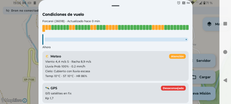
Hay una pregunta que cualquier piloto de drones se...
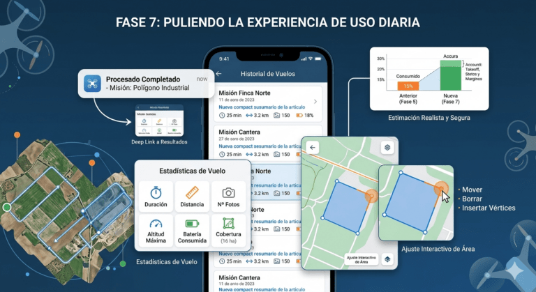
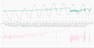
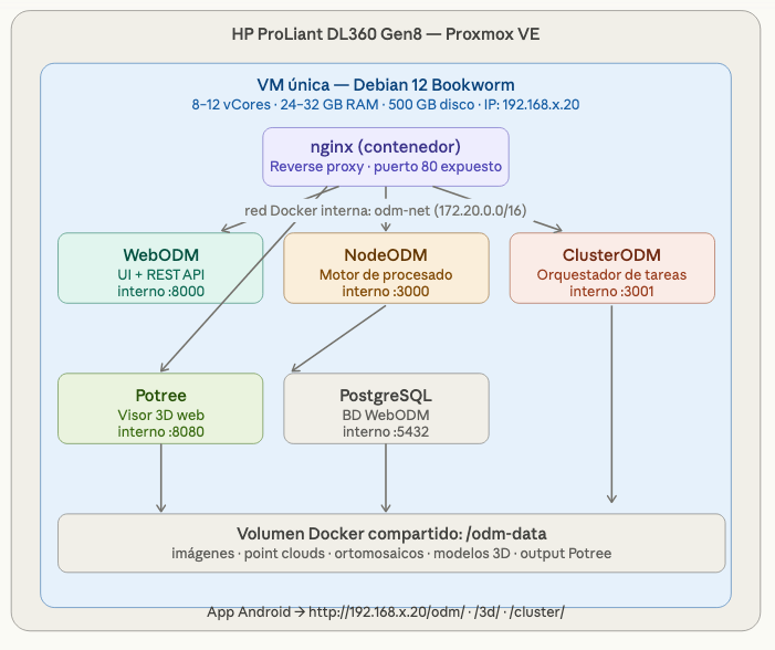
La Fase 6 cerró el ciclo principal de la...
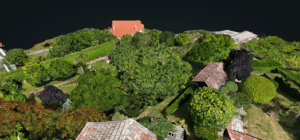
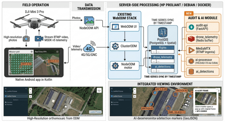
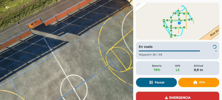
Hasta la Fase 5, la aplicación era capaz de...
En el artículo anterior de esta serie describí el...
Cuando empecé esta serie de artículos, el objetivo era...
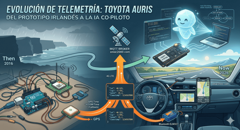
Allá por finales de 2016, cuando aún vivíamos por...
En los artículos anteriores de esta serie describí cómo...
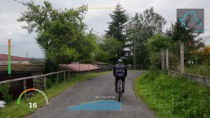
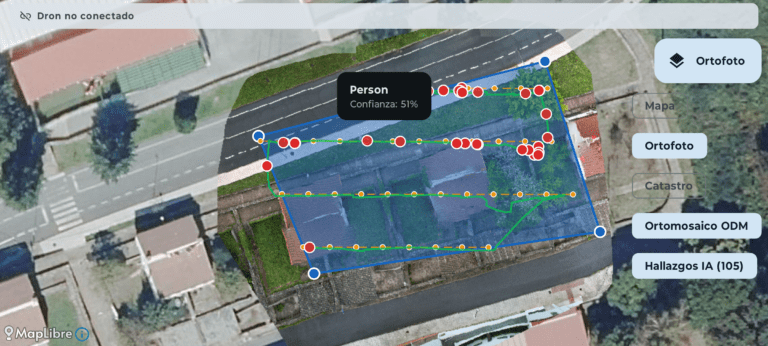
Hasta ahora los artículos de esta serie se han...
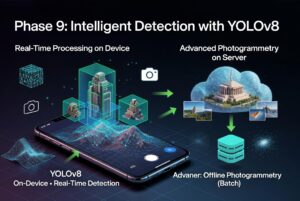
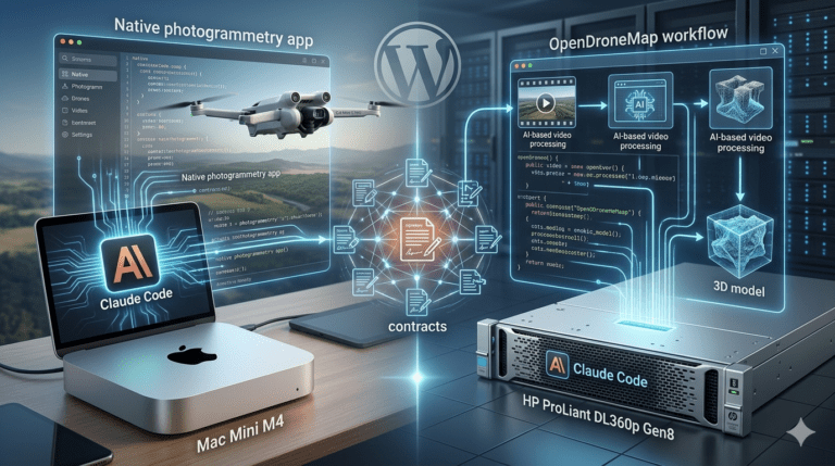
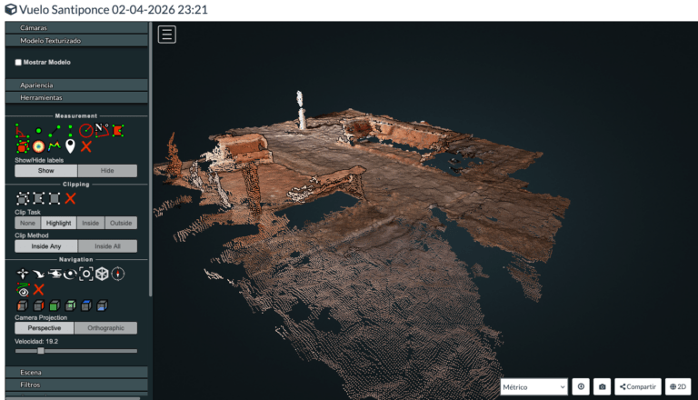
En el artículo anterior de esta serie expliqué cómo...
Llevo ya cerca de un año con el Mac...